10 Essential Stops on the Southern Oregon Coast

We ended our Oregon Coast Highway 101 vanlife road trip on a high note on the southern border of Oregon. With rugged cliffs, natural arches offshore, 19th-century lighthouses, and strange formal flower gardens that once belonged to a lumber baron, there are lots of great spots to discover in the southwestern corner of the state.
1. Shore Acres State Park
Standing atop a tall sandstone cliff, Shore Acres State Park is kind of a strange, unexpected place. The former estate of a lumber baron, the once wealthy Simpson family was forced to sell the estate to the state of Oregon after the Great Depression. The mansion and most of the buildings were torn down, but the beautiful formal English Gardens and Japanese gardens have been restored. You don’t expect to see perfectly manicured gardens perched on craggy headlands carved by violent waves.

Shore Acres State Parked is perched atop a rocky headland, but it has these beautiful formal gardens.
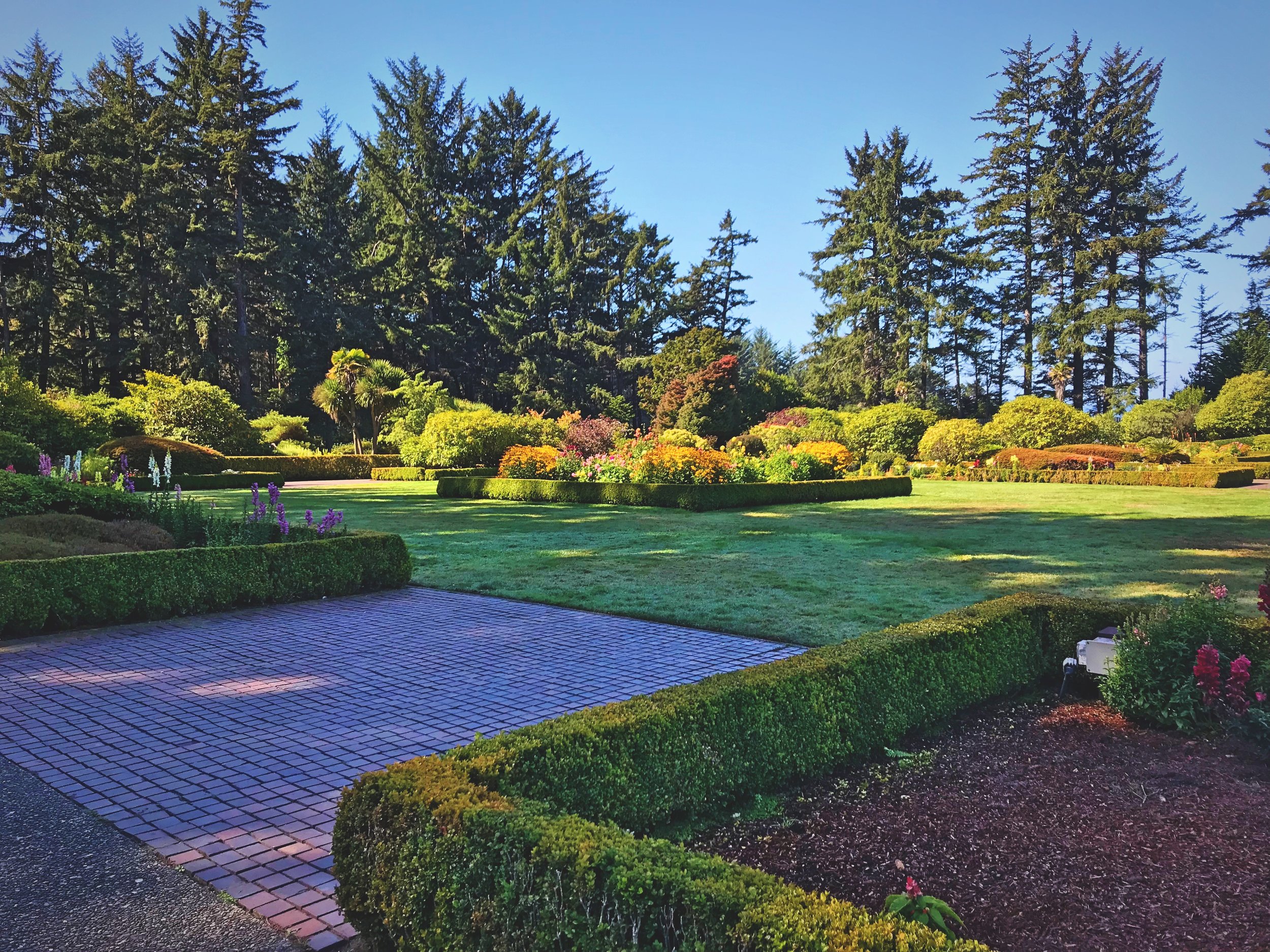
Spend a morning exploring the grounds at Shore Acres State Park on the Oregon Coast.
Shore Acres State Parks has several rose gardens—as beautiful in the International Rose Test Garden in Portland, though much less sprawling (click the link to read our blog post about Portland’s rose garden). Even in late September, when we visited, there were still hundreds of rose blossoms to enjoy at Shore Acres..

Even in September, the roses were in bloom.

Shore Acres has two rose gardens.

There are a lot of unique varietals of roses.

Although the mansion was destroyed, the gardens have been restored.
The Dahlias were blooming when we were there. There were hundreds of the many-petaled blossoms in all colors and sizes. The Japanese Garden has a huge lily pond in its center. The pond is home to a small school of coy. Low trees, pruned shrubs, and artfully placed plants surround the dark pool.
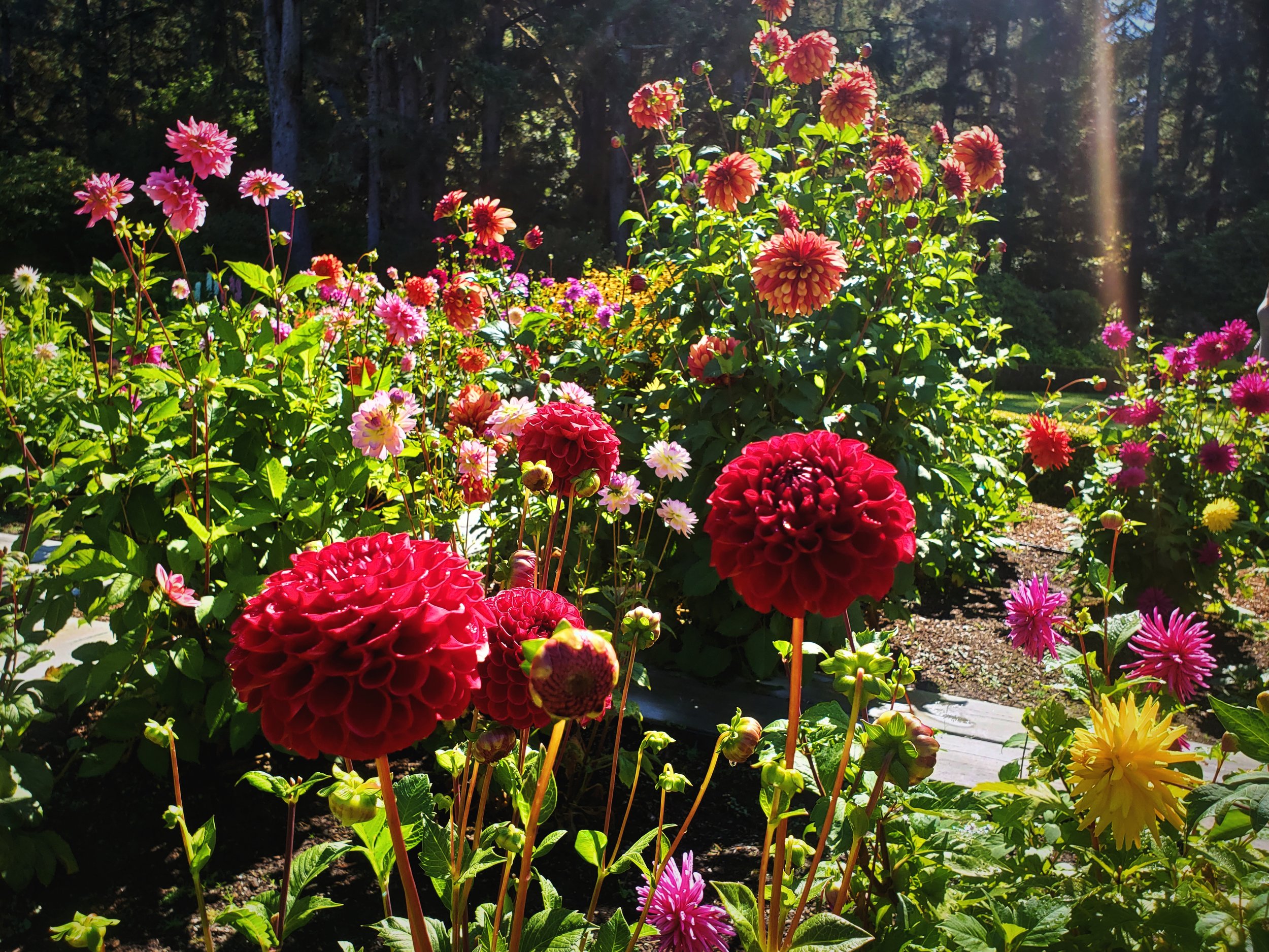
Perhaps, even more beautiful than the roses were the Dahlias in the center of the English Garden.

So many colorful blooms at Shore Acres State Park on the Cape Arago Highway.
Don’t miss the monkey puzzle tree on the grounds. This endangered tree is a native of Argentina and Chile, so it’s not something you’d expect to find on the Oregon Coast. Thousands of tough, overlapping, triangular leaves line it’s branches. Nearby you’ll find at tree that belongs to the “National Big Trees Registry,” the National Co-Champion Heritage Monterey Pine. Nearby you can find a sweltering greenhouse filled with flowers, house plants, and tropical plants.

The Monkey Puzzle Trees has crazy branches.

A flower in bloom outside the greenhouse at Shore Acres State Park.
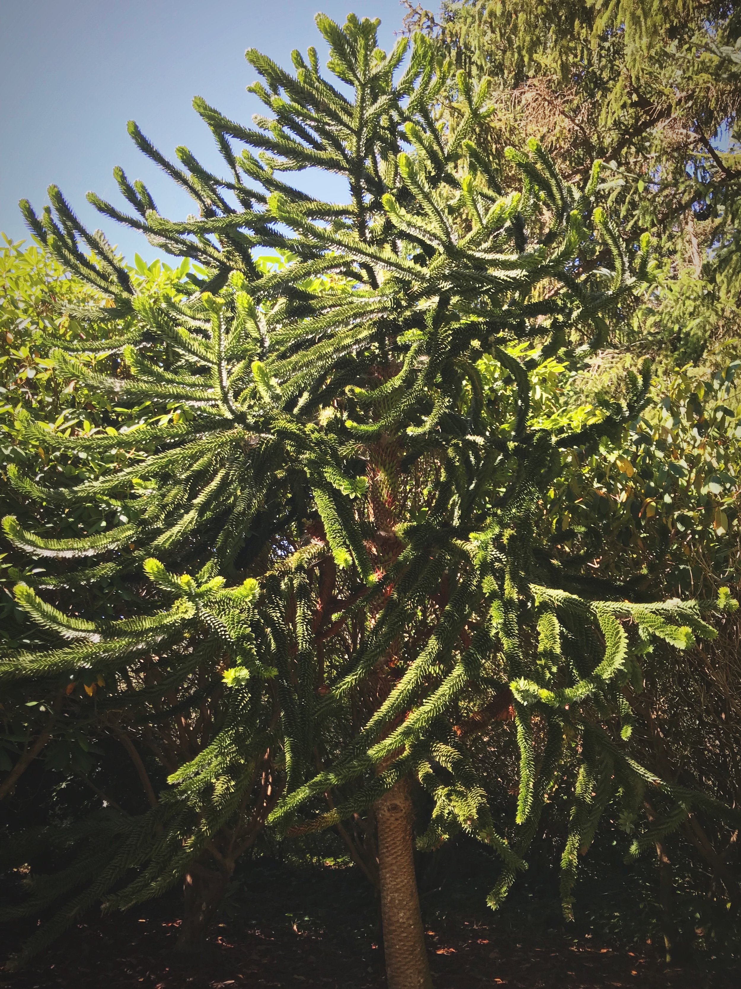
You really would not expect to see one of these trees on the Oregon Coast.
Where the Simpson Mansion once stood, there is now an enclosed viewing area where you could watch the waves crash into shore even on rainy days.

The greenhouse holds still more botanical treasures to discover.
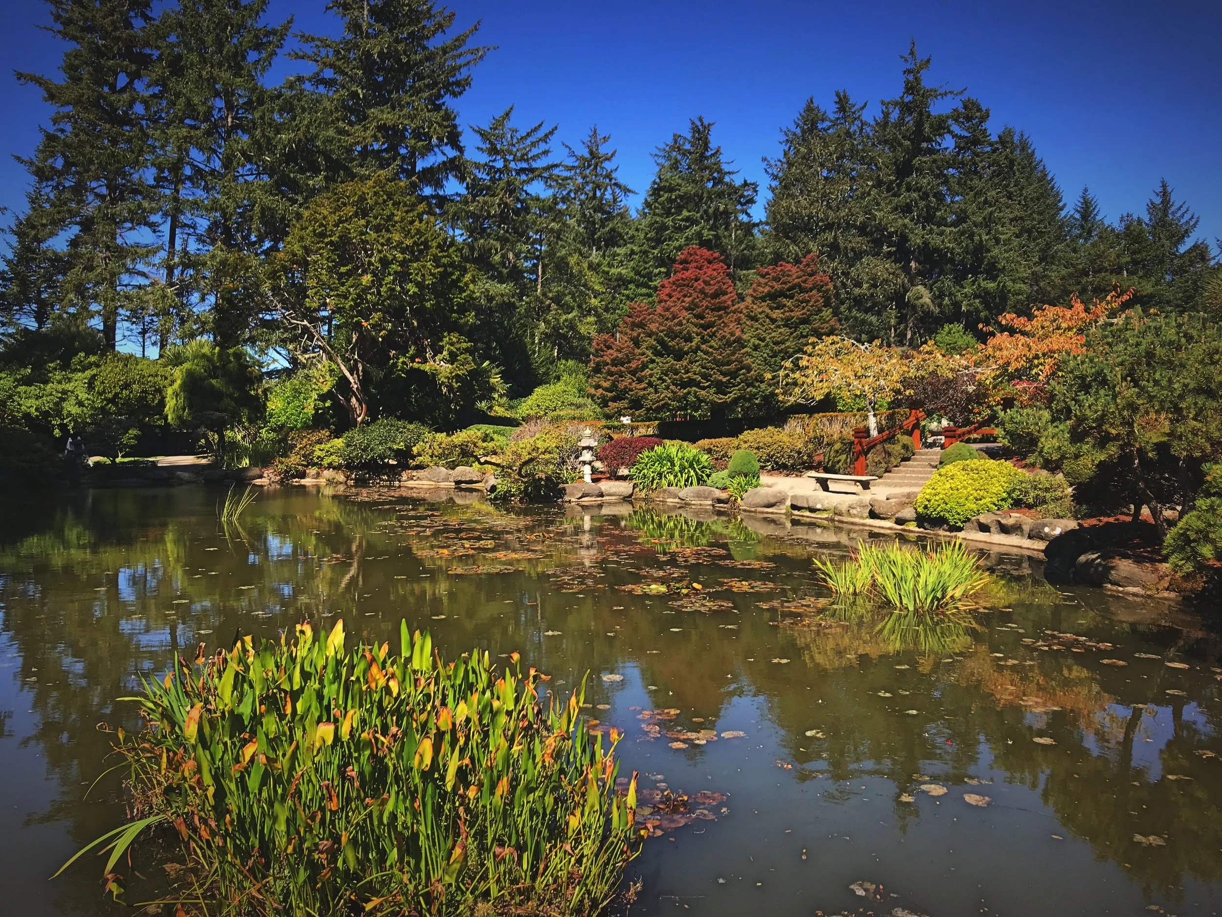
The Japanese Garden is as beautiful as the English rose gardens.
One of the great things about Shore Acres State Park is that it has a trail that runs along the shore leading you to Simpson Reef and Cape Arago. We ran the three-mile, round-trip trail, although on a Saturday morning it was a bit busy for running.

Ian couldn’t resist climbing on these blobby rocks.

These concretions are so cool, but the shark fin formation at the entrance of the cove is also very unique.
The trail begins with a steep descent to Simpson Reef. The beach has a large shark fin sea stack that sticks out of the water at the 45-degree protects the small. By the shore there is smooth sandstone with insane blobby stone concretions sticking out of it. It was unlike any rock we have ever seen before.
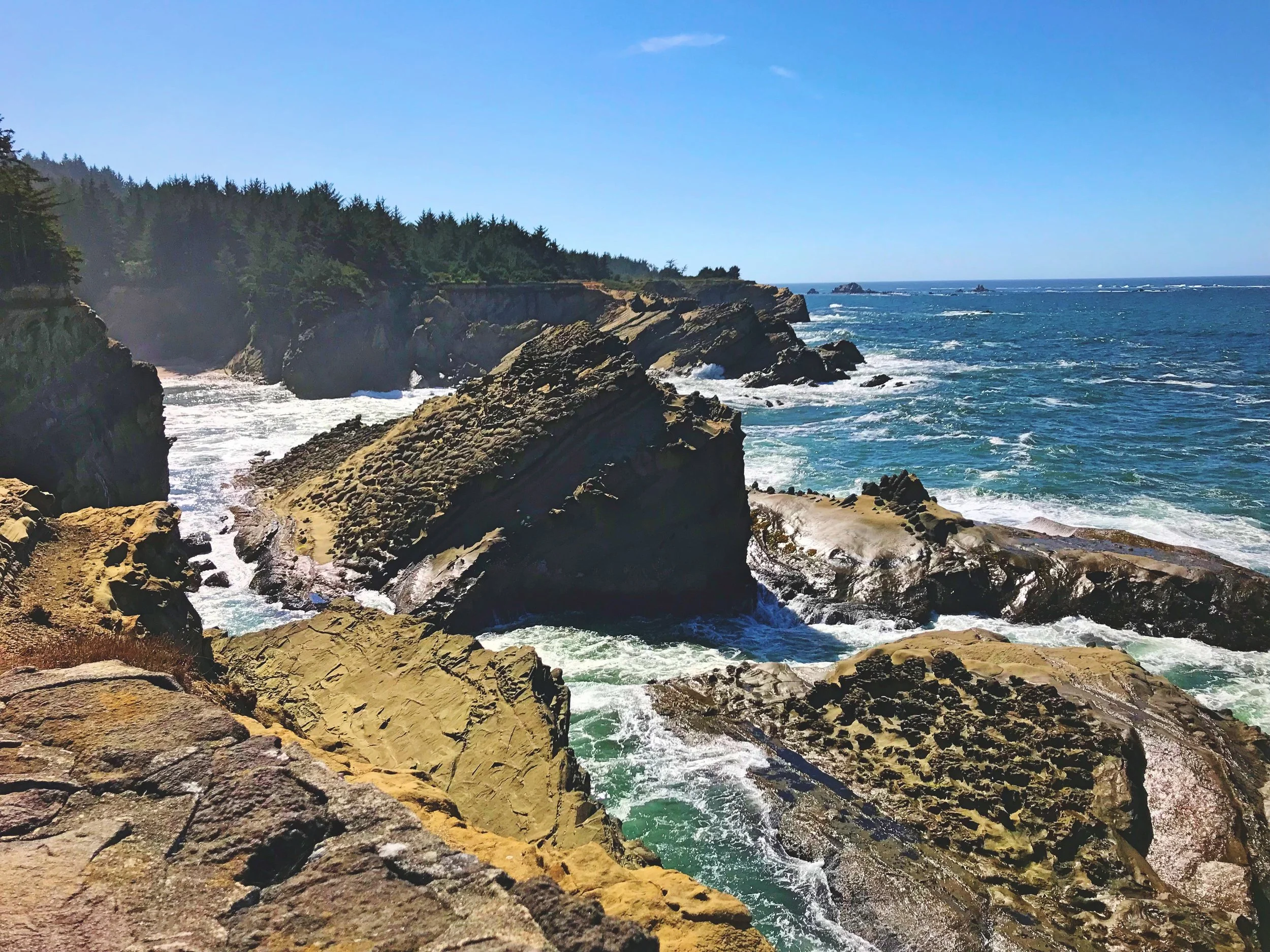
From the trail on the headland above the cove, you can see the jagged rocks that line the shore.
Past Simpson Beach, we had to climb back to the top of the headland well above the ocean. The trail twists through areas of coastal forests, but other areas are more open and densely covered with salal. At some points, you are right on the edge of steep drop-offs to the ocean. On the edge you are afforded multiple views of Simpson Reef.
2. Simpson Reef
From an overlook high above the Pacific, you can spot thousands of sea lions resting on rocks offshore. The largest rock that they lay on is called Shell Island, but there are even more on the sandstone platforms that are Simpson Reef further out. Simpson Reef is the largest sea lion rookery in Oregon, but you’ll likely also see seals out on the rocks. Without binoculars the sea lions and seals just look like brown blobs out on the rocks, but you can hear a raucous baying even from so far away.
Besides seals and sea lions, there are also lots of sea birds like common murres, cormorants, gulls, pelicans, and puffins. Later in the day, we even spotted some whales spouting far off shore.

Visible from the Oregon Coast Trail are some of the sandstone formations that make up Simpson Reef.
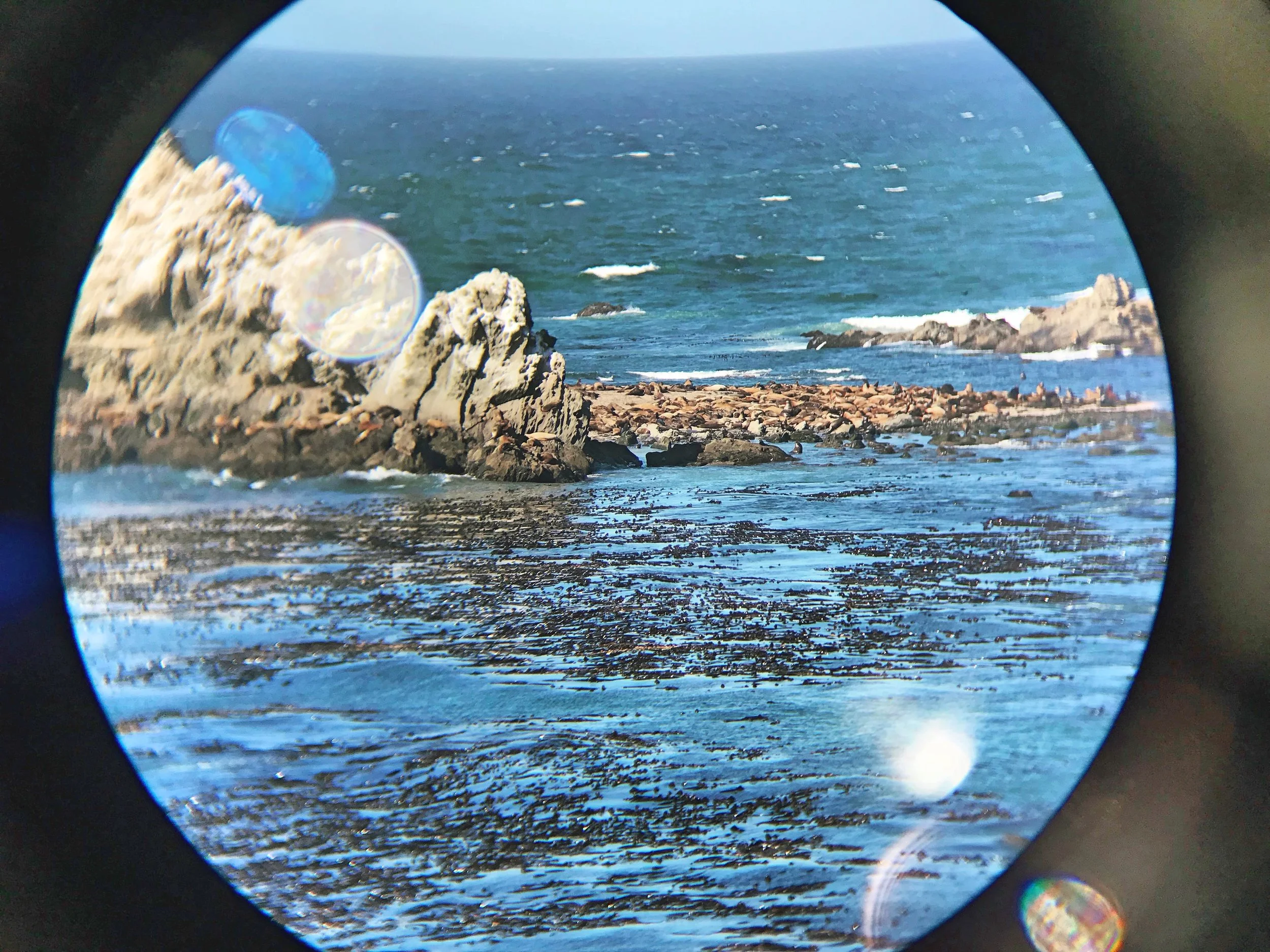
Don’t forget to bring your binoculars so you can get a view of the sea lions and seals on Simpson Reef.
3. Cape Arago State Park
From Shore Acres State Park, it’s only a few minute drive on the Cape Arago Highway to Cape Arago State Park at the end of the road. Cape Arago is a tall headland that juts out into the Pacific. At the end of the cape is the Cape Arago Lighthouse, but unfortunately it’s closed to the public. Besides views of the light, looking down on either side of the cape there are beautiful rocky coves.
4. Charleston
Charleston is an adorable fishing village. Stop for happy hour at the quirky Miller’s at the Cove. The bar is in an old church and still has a steeple and the lancet windows. Don’t worry though, they’ve upgraded from pews to high tops and bar stools inside.
5. Cape Blanco State Park
Cape Blanco is a very tall headland on near Port Orford, Oregon. Perched atop the cliff is a 19th century red and white lighthouse. The lighthouse was built in 1870, making it the oldest standing lighthouse on the Oregon Coast. We decided not to take the $2 tour since we had recently visited a few other free lighthouses (Cape Meares, Yaquina Head, and Heceta Head Lighthouses) further north along the coast.

The Cape Blanco Lighthouse is the oldest on the coast of Oregon.

We spotted this mosaic depiction of the Cape Blanco lighthouse in Port Orford, Oregon.
Besides the lighthouse there are trails that give access to the beach and tide pools on the rocky shore. The shore is rocky and spotted with sea stacks. It was insanely windy and cold on top of the cliffs when we visited in September, so we didn’t spend much time exploring the grounds surrounding the lighthouse.
6. Port Orford
Painted on the road on a hill in Port Orford, Oregon is “Ocean View” and a giant arrow. When you see something like that, it’s impossible not to check it out. We discovered an expansive view of the ocean and Battle Rock to the south. At the viewpoint there is an artful bench mosaicked with a nautically themed scenes.
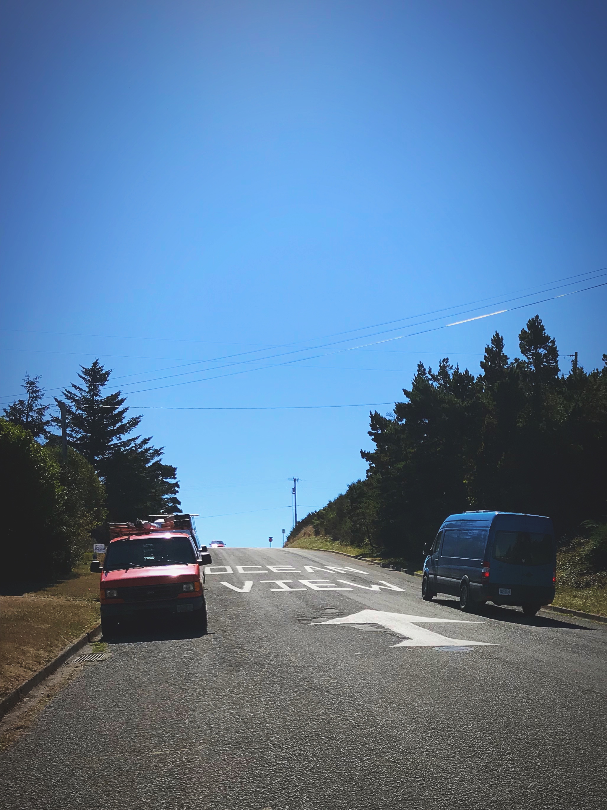
How can you resist driving up a road with a sign like this.

Besids the view, there was this really cool mosaic bench at the viewpoint.
“Ocian in view! O! The joy!”
7. Ophir Beach
Ian thought it would be a good idea to go for a run on the beach. I said, “Okay, if you really want to...” Near Ophir, Oregon, we discovered the perfect beach for a run. Ophir Beach is a nearly 5.5 mile open stretch of beach where we did a short, but by no means easy run. The beach was beautiful and we had it all to ourselves, but it was so windy and running on soft sand is very difficult. Because of the wind, the waves were crashing up on to the beach, and we both got our feet soaked a couple of times when waves came unexpectedly far up the shore. I think Ian pretty quickly realized the mistake he’d made, but I wouldn’t let him quit early!
8. Gold Beach
Another cute coastal town is Gold Beach. We explored a few art galleries and found a great coffee shop and used book store to warm up on the chilly fall day.
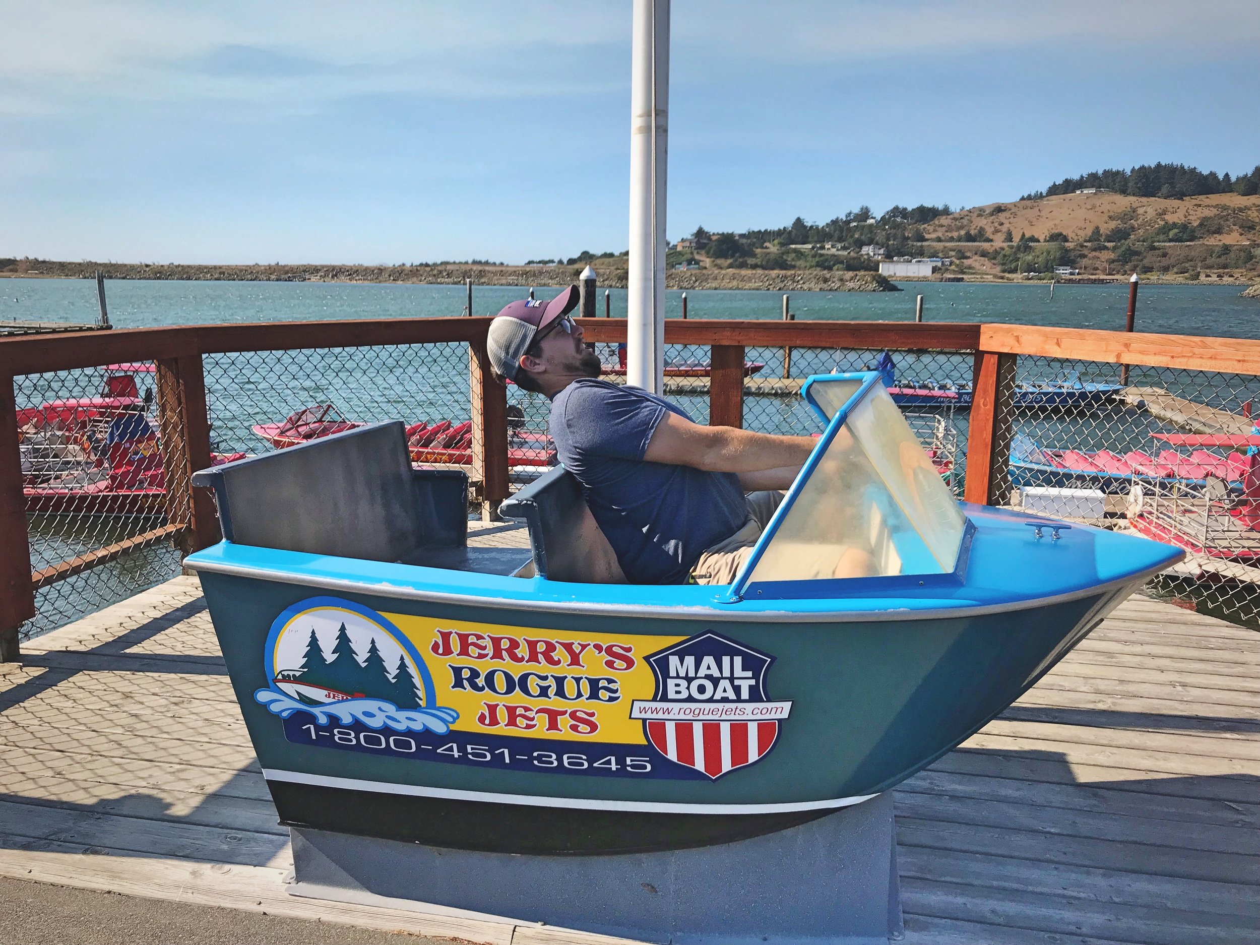
We had a lot of fun just messing around in Gold Beach.

We are ready for our guided boat tour, Jerry!
9. Samuel Boardman State Park
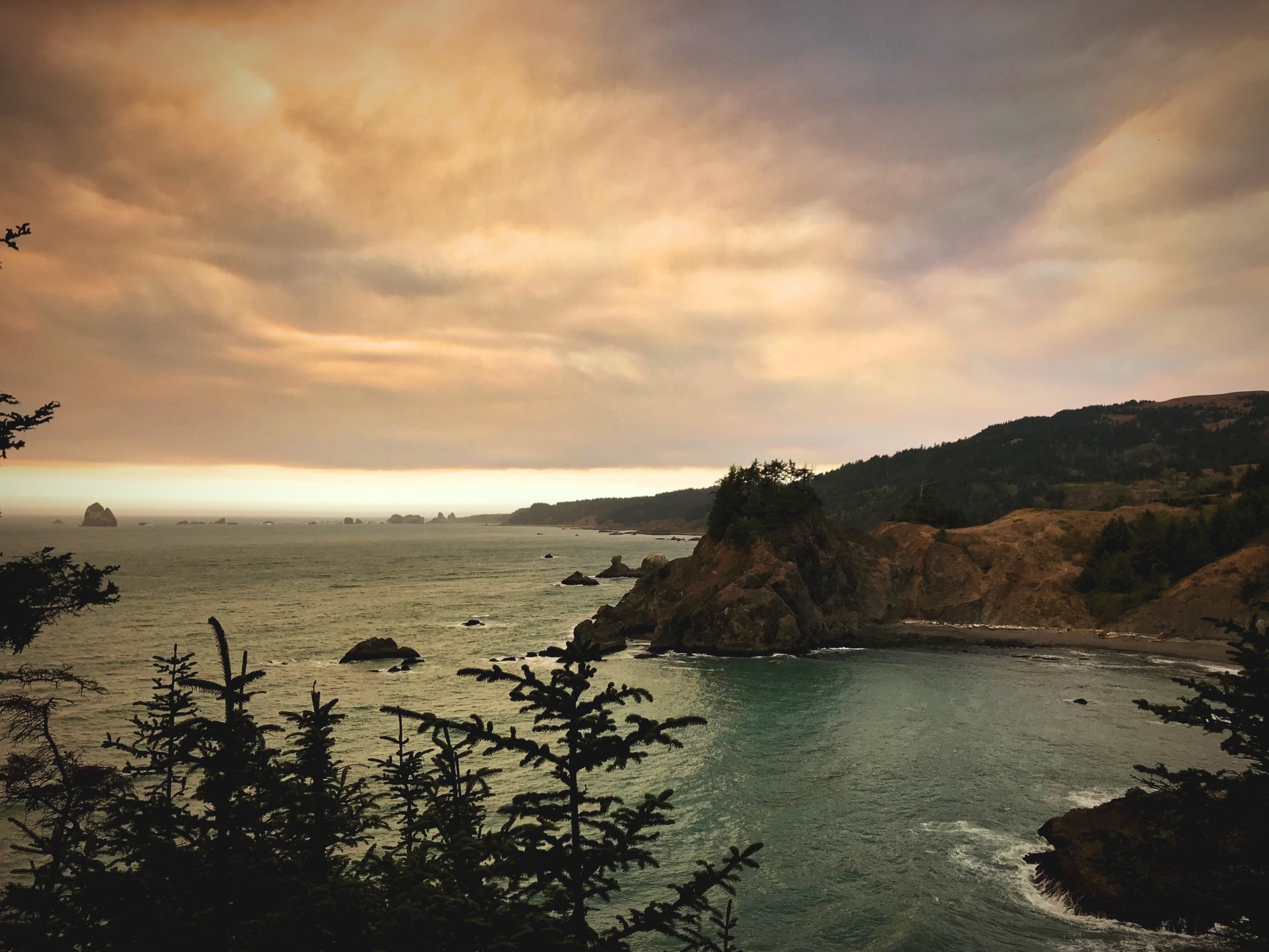
Samuel Boardman State Park skirts 12 miles along the Oregon Coast on the southernmost section Highway 101 before you get to the northern California border. Because it’s so close to California, it’s supposed to be a lot sunnier than the rest of the Oregon Coast. We were lucky during our Oregon Coast road trip because it was sunny almost the entire time.

The wildfires nearby made for the most strange afternoon light we have ever seen.

The smoke drifting north from fires inland in Oregon and California stained the otherwise blue sky orange.
With wildfires raging nearby, as we drove south into the park the sky began to turn from blue to an eerie orange color. It felt like the sun was setting except that it was 2:00 in the afternoon. A diagonal line divided a blue sunny sky from the dark smoke filled sky. The waves below the orange sky were a coppery tone as they washed into store. I’ve never seen anything like it. It looked beautiful, but it felt tragic.

The waves turned a coppery color because of the reflection of the sky.

We spotted this guy taking in the ocean over a shipwreck on the beach.

Most of the Oregon Coast is dotted with sea stacks.
Samuel Boardman might be the most Instagrammed portion of the Oregon Coast, but early in the 12-mile stretch we discovered a less Insta-famous section of the park. We parked our Sprinter at a small pull-off and discovered a trail leading down to an unnamed beach. Half buried in sand on the beach are the remains of a fairly recent shipwreck of a boat called the Crow’s Foot. We couldn’t find any information online about the shipwreck, so we have no idea what the story is behind it.

We don’t know the story behind the Crow’s Foot shipwreck. Add a comment below if you know any information about this shipwreck!

Between the purplish orange sky and the shipwreck this beach was pretty eerie.
Further south in the park we visited Arch Rock. To view the natural arch in a sea stack, you walk out on a forested spit that sticks out into the ocean. In general Samuel Boardman State Park seems to be more densely wooded, which makes sense, because only 20 miles to the south you’ll find Redwood National Park.
Arch Rock is a huge natural arch surrounded by other gray sea stacks. Samuel Boardman is one of the most rugged stretches of the Oregon Coast, and this is completely evident at Arch Rock where jagged rocks sprout out from turquoise water. Since the water is so light on this section of the coast you can see kelp beds growing beneath the surface of the water.

Arch Rock surrounded by the green waters and kelp beds of the southern Oregon coast.
A view North from the Arch Rock lookout trail.
Further south still, you’ll find the Secret Beach, Thunder Cove, and the Natural Bridges Trail. Technically you could hike on the Oregon Coast Trail through the entire 12 miles of Samuel Boardman State Park. But you can also just drive to the different sites that you want to see and then hike into them from Highway 101 like we did. We hiked a portion of the Secret Beach/Thunder Cove Trail and a portion of the Natural Bridges Trail. Secret Beach is a smooth sandy beach tucked into a small cove filled with rough sea stacks.

Trees struggle to hold onto the tops of these rugged rocks.

One of the natural bridges peeking out from behind a curtain of trees.

A view of the small rock islands along the Secret Beach Trail.
The Natural Bridges Trail has several natural arches off shore or connected to spits of rock extending from the cliffs of the shore. Many of the sea stacks have pine trees standing atop them, clinging tenuously to life in this wind-stricken, saltwater environment.
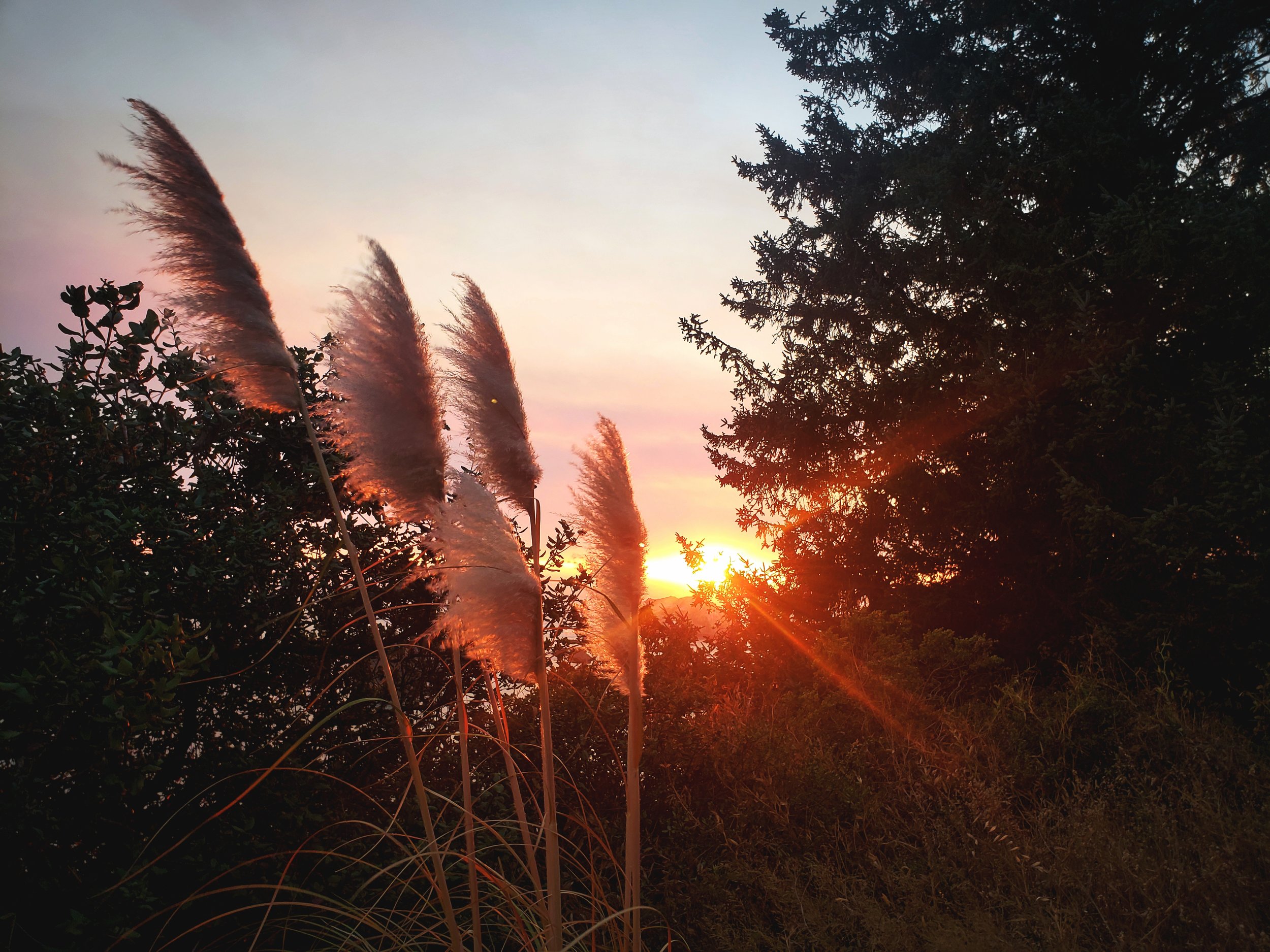
10. Brookings
We watched the actual sunset (not the wildfire smoke faux sunset) from above a beautiful beach in Brookings. The sunset was a gorgeous blend of subtle colors, but because of the smoke after the sunset the sky turned this absurd deep orange and maroon color, rather than the typical deep blue of dusk. I have truly never experienced anything like that. Plus the air smelled like a campfire, making the evening even more strange.

This is the view at sunset from a pull off along Highway 101, just outside Brookings, Oregon.
What a perfect way to conclude our Oregon Coast road trip.

Most of the Oregon Coast is rocky, but the southern end seems to be especially rugged.
Free Camping Nearby:
Near Port Orford- We spent a night camped in the Rogue River-Siskiyou National Forest. The spot was a pull-out along Elk River Road in a steep valley. Below us the Elk River was blue and crystal clear, and the bottom of the river is smooth gray stone rather than sand or stones. If you’re looking for solitude this is a prime spot. We didn’t see another person on this road the entire time we were there.

This road was really quiet. In a pinch, you could probably pitch a tent here, although there wasn’t much flat ground.

The Elk River was mysteriously blue below us. The slope was too steep to get down to it from our spot.
Near Brookings- We had planned to spend a second night in the Rogue River-Siskiyou National Forest, but because of the Klondike wildfire raging in the national forest, we had to camp closer to Brookings. We ended up camping on a pull-out along Old County Road just outside Brookings. It really wasn’t the best spot, but in an actual emergency situation, it was a great place to spend the night.
Posts also tagged:
Arches, Arch Rock, Beaches, Brookings, Cape Arago, Cape Blanco, Cape Meares, Charleston, Coos Bay, Elk River, Flowers, Food, Forest Service Land, Free Camping, Frugal Travel, Geology, Gold Beach, Heceta Head, Highway 101, Hiking, History, International Rose Test Garden, Lighthouses, Main Streets, National Forests, Natural Bridges, Ocean, OPhir Beach, Oregon, Oregon Coast, Photography, Port Orford, Public Land, Road Trip, Rogue River-Siskiyou National Forest, Roses, Running, Samuel Boardman State Park, Sea Stacks, Shipwrecks, Shore Acres State Park, Simpson Reef, State Parks, Tide Pools, Trail Running, Trails, Travel, Trees, Vanlife, Wildfires, WildLife, yaquina head
Do you know the story behind the Crows Foot shipwreck? Let us know about your favorite spots on the Oregon Coast! Leave a comment below.