Three Days of Backpacking on the Ä’äy Chù West Trail and Observation Mountain

The Kaskawulsh Glacier can be viewed from the top of Observation Mountain or by plane.
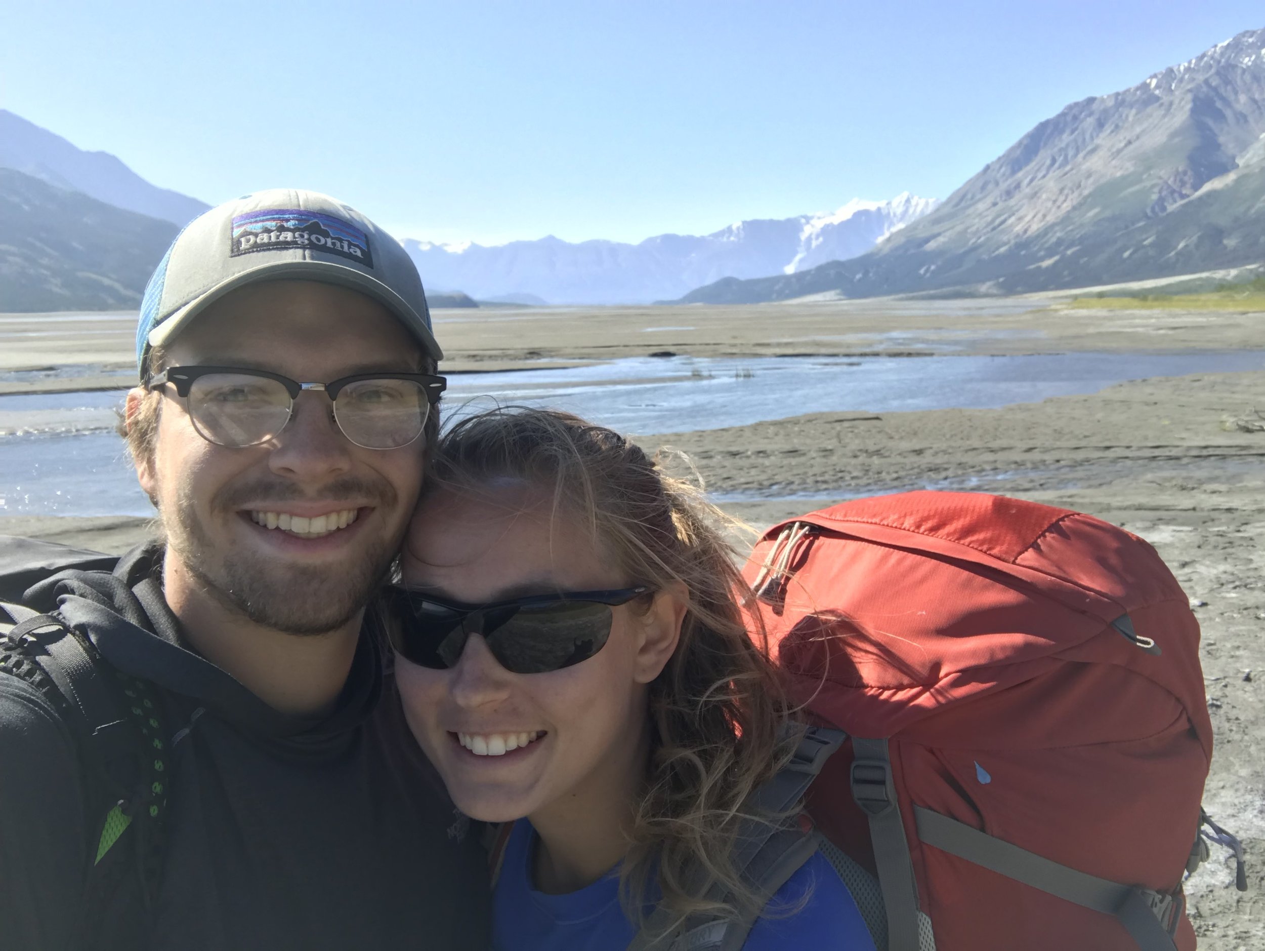
At the end of July, we completed a three-day backpacking trip in Kluane National Park in the northern Yukon. Although we had been traveling for nearly four months, we had yet do an overnight backpacking trip, even though it’s one of our favorite things to do. Ian and I went on a backpacking trip for our third date! When your home can be parked at any trailhead, it’s easy to forego backpacking trips in favor of day hikes. However, in the Yukon, where the beautiful sites are less accessible, and there are few developed trails and even fewer roads, we decided it was time to dig the backpacks and our tent out from under the bed for a longer excursion.
Our route took us up the western side of the Ä’äy Chù (Slim’s River) Valley on day one. On day two, we summited Observation Mountain to get a panoramic view of the Kaskawulsh Glacier and the river valley. On day three, we hiked back out.
Preparation
While this hike was a relatively short trip in terms of days, it was a strenuous trek across 45 miles of terrain. The hike involved multiple difficult stream crossings and included highly varied terrain. The path to the summit of Observation is considered an unmaintained route, rather than a maintained trail, so it does involve some navigation and route finding. It was certainly the steepest hike either of us has ever done.
Kluane National Park is very remote as well. The Yukon only has around 35,000 people, about 75 percent of whom live in the capital Whitehorse. If anything goes wrong out there, you know it would be a while until you could be rescued and even longer until you could reach medical services. Parks Canada emphasizes that you must be self-sufficient during your trip.
Still it is one of the more popular backpacking routes in the Yukon. It’s also one of the most accessible, in an area where much of the land can only be reached by bush plane. There’s lots of great information online to help with planning, from Parks Canada and other people who have done the hike.
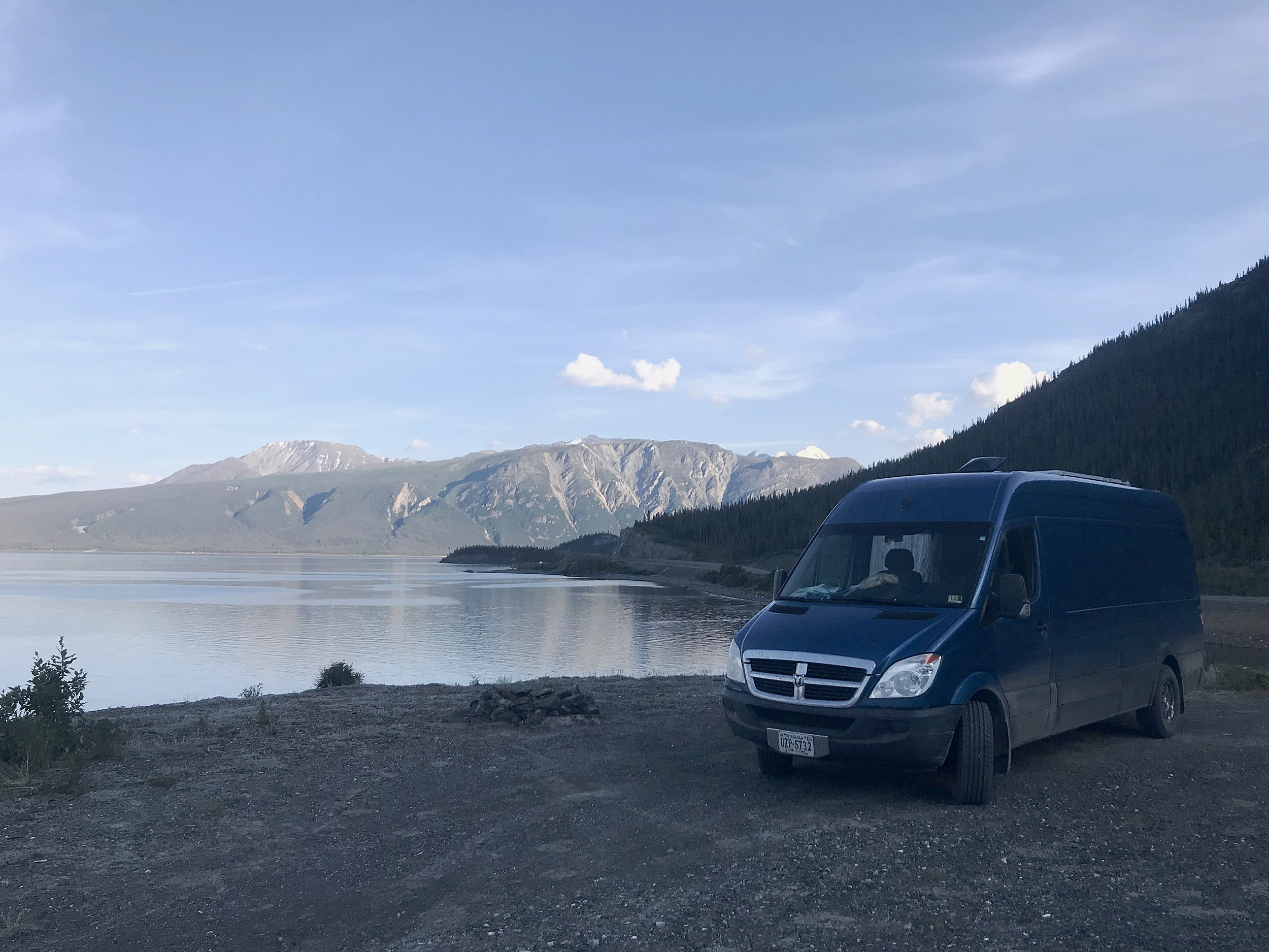
Our beautiful camping spot right by Kluane Lake.

A two-foot summer sausage--essential for every wilderness trip.
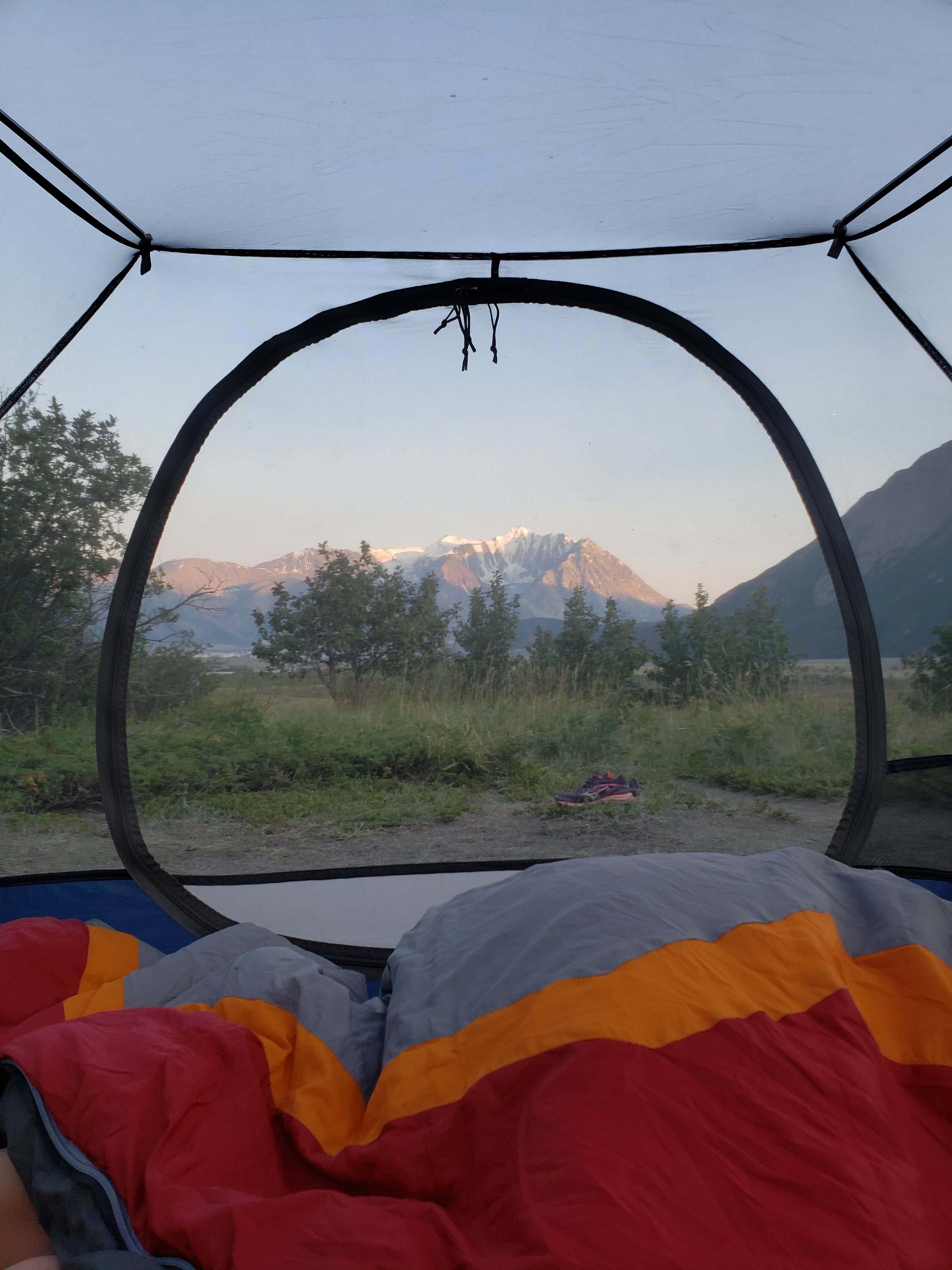
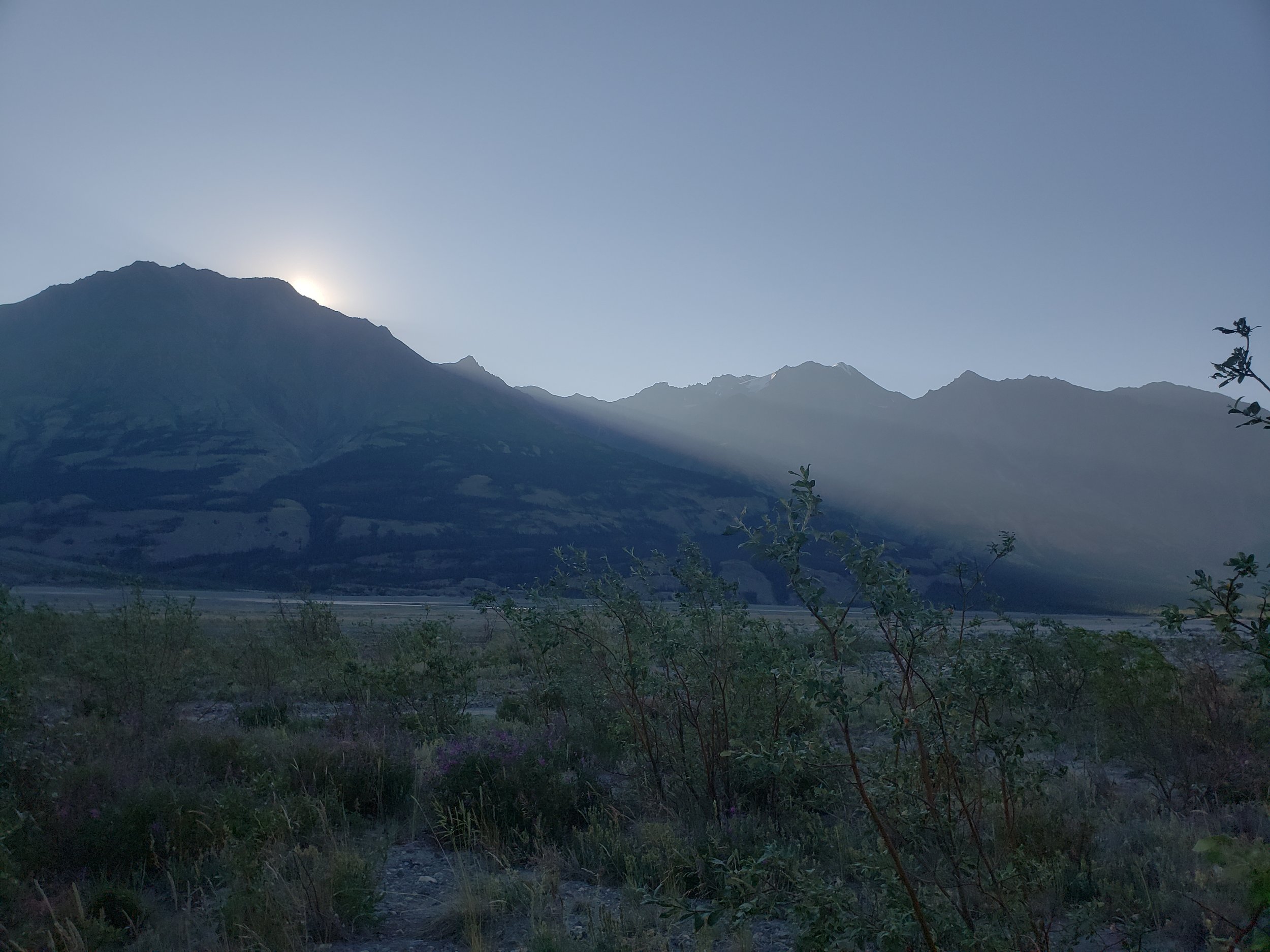
The night before our hike, we found a great place to park for free at the top of a ridge overlooking Kluane Lake. Kluane Lake has been called the most beautiful lake in the world with reason. It is ringed with beautiful mountains, and the perfectly clear water stretches for miles and miles. It was a lovely place to pack up our backpacks and eat dinner.
Day 1
The next morning we had to wait until 9am before we could leave because we had to register with Parks Canada. It was a much more comprehensive wilderness permit process than the self-registration we are accustomed to in the US, asking us questions about our experience, if we had a satellite phone, and emergency contact information. They made sure we had a bear canister. We already had an Ursack, a thick Kevlar sack which prevents bears from getting your food. If we had not had our own bear-proof food storage, the park would have rented us a hard-sided canister to use for our trip.
The registration also included a deregistration, something we’ve never done in the US. If we didn’t check out after our trip, they would be out looking for us in 24-48 hours. Kluane might be remote, but Parks Canada takes wilderness travel in the park very seriously. The rangers were very helpful and friendly. The permit cost us $10/night per person, around $32 USD in total. We usually try to do as much travel as we can for free, but we considered this a fair price considering the check out process and how helpful the rangers were.
We were on the trail around 9:45 am. The first 2.8km of the trail follows an old two track that was used for gold mining until about the 1940s. In the early 1900s there was a gold rush on Bullion Creek, and the trail is lined with the rusty detritus of the mining era. Kluane is an arid region of the Yukon, and this portion of the trail is hot and dusty.
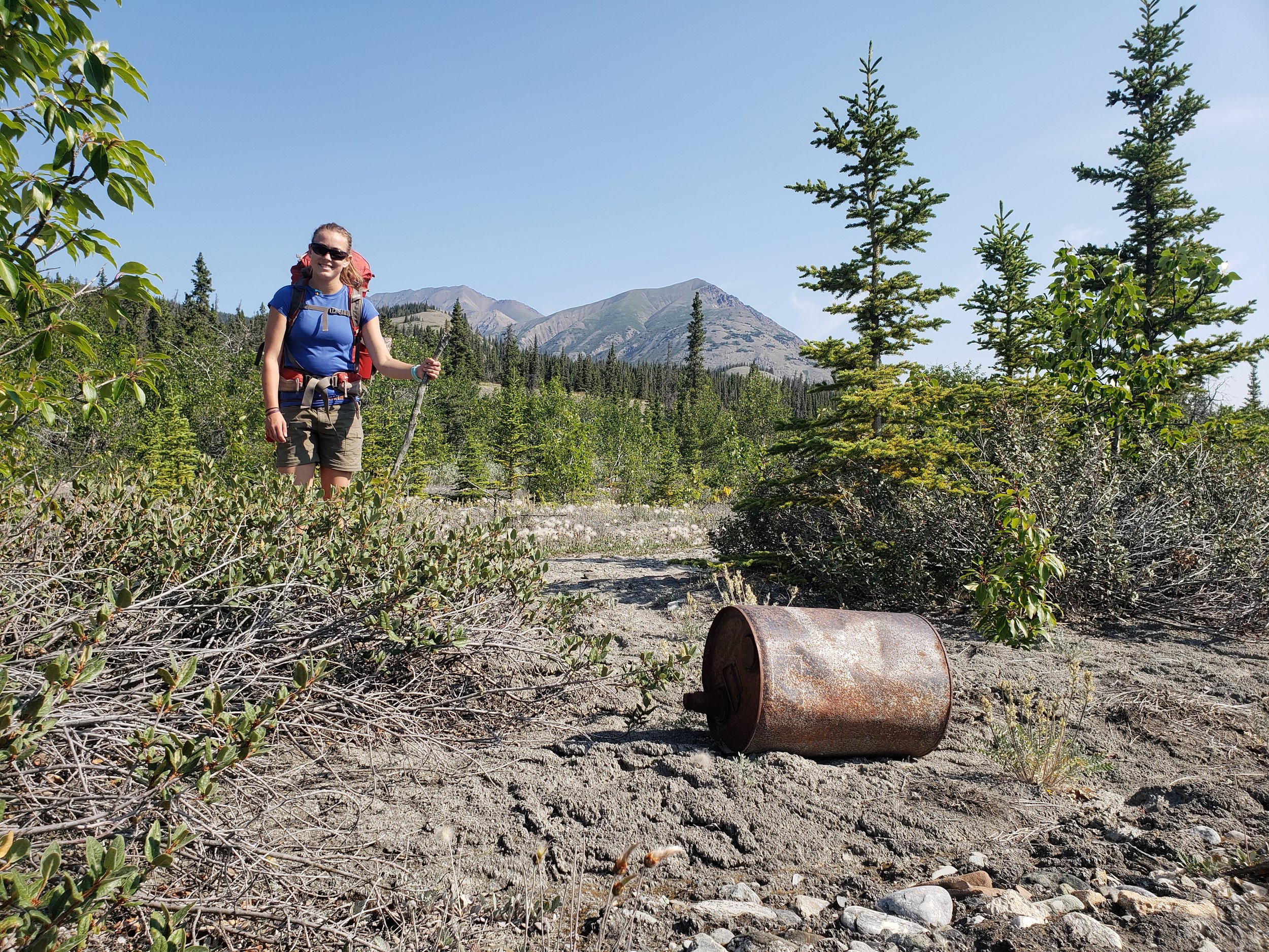
The remains of the Bullion Creek Gold Rush near the trail.

The trail was surprisingly dusty and much drier than we expected.
At 2.8 km, after the trail departs from the mining road, we had to undertake our first stream crossing—Sheep Creek. It was a very easy crossing. Ian didn’t even get his feet wet, instead jumping from rock to rock.
Ian’s dry feet didn’t last for long though. Soon after, we came out of the trees into a wide boggy wet area of sedge grass. There’s a board walk that pointlessly goes about 10 feet into the bog and then we just had to walk through the standing water.

Ian's feet did not stay dry for long. There are random boardwalks throughout the trail, but they don't keep you from walking through standing water.
The second stream crossing is at Bullion Creek around 5.8 km. Bullion Creek is faster and deeper. We had been warned that the crossing might be difficult by the rangers, but again we had an easy time crossing.
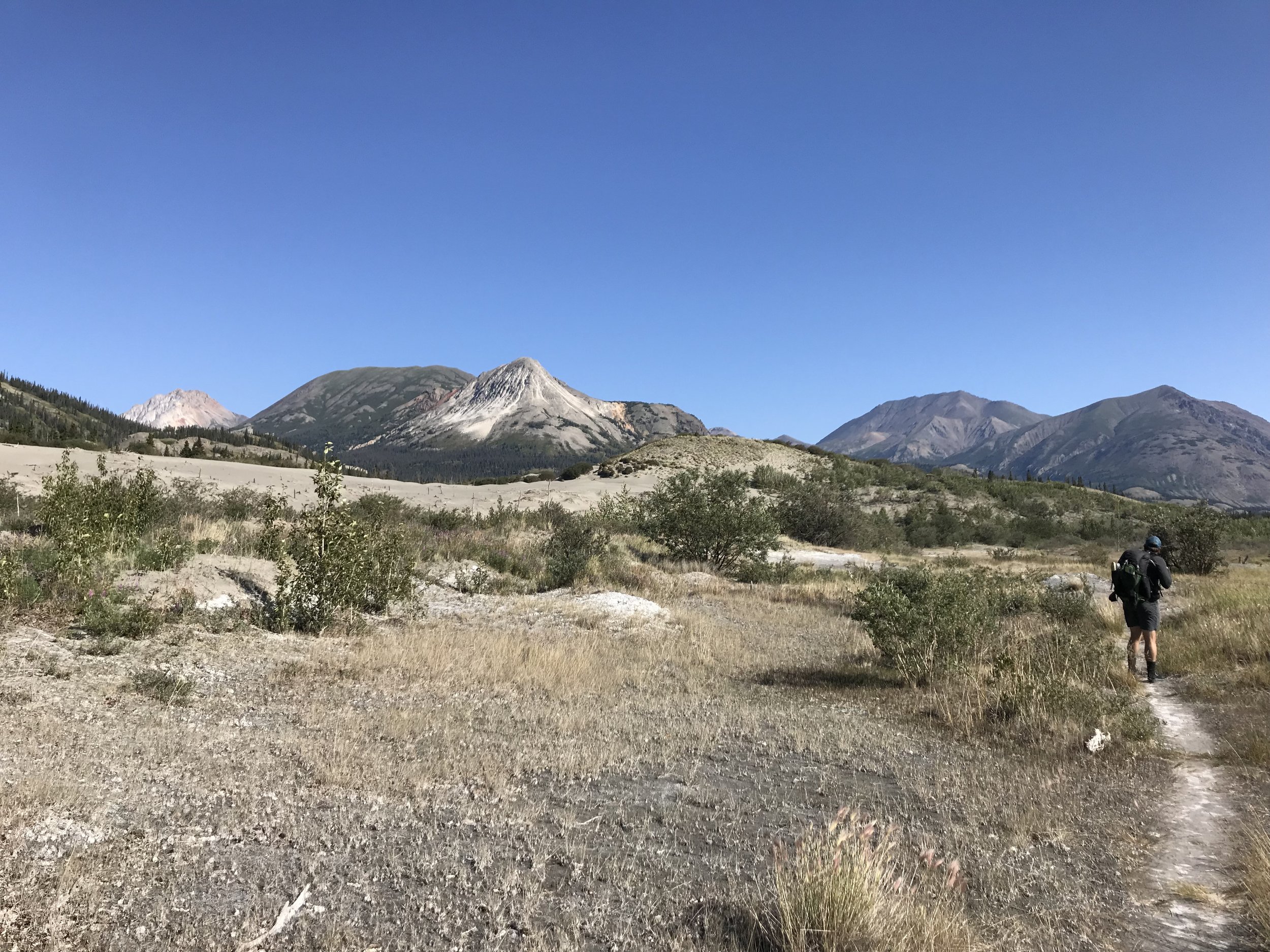
Past the creek, are the sand dunes. The sand dunes are strange and beautiful, with the colorful, highly mineralized mountains towering behind. After the dunes the trail goes through an area of dry salt flats, where the mud is covered with a crust of white minerals.

The sand dunes made us feel like we were walking on the beach.

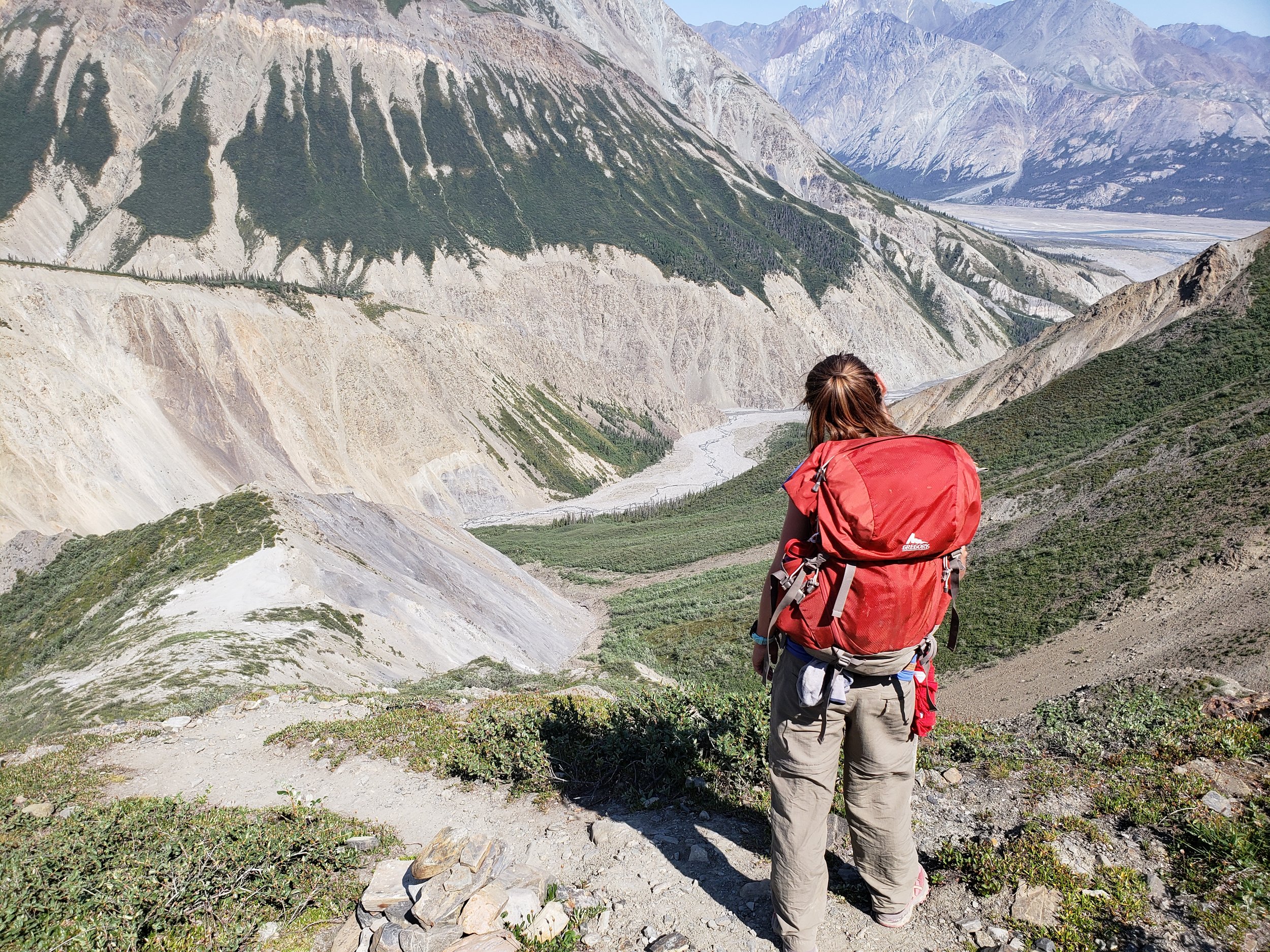
Kaylee hikes toward the mountains of the Kluane Ranges at the end of the valley.
We ate lunch in the salt flat area, where we saw four people walking out on the mudflats down by the river. We learned soon that there are two possible routes for the 6km after the 8km mark. When it’s drier, you can walk down by the mud flats on easier ground, or when the water is high, you can walk on the rougher terrain above the valley floor in the trees.
Soon after lunch, we descended down to the mudflats. It was easy walking on the mud. It’s flat and a cool breeze consistently blows through the valley off the glacier at its southern end. Being next to the river we were also able to get full views of the on either side of us of the mountains.
It was about 80 degrees in the afternoon, and we were grateful to be in the breeze and by the water. At one point, Ian decided to take a bath in a small pool of water that had been left behind when one of the braids of the river changed course. The sun had warmed it, and it was perfectly clear. Of course once we got in, we stirred up the sediment and it wasn’t so clear any more.

Ian enjoys a little bath time.
Walking out on mudflats was easy and cool in the breeze.

One of the many small streams that you have to cross. Some of these were dry on the first day and flowing on the third day.
From 11km to 17km, you cross several alluvial fans. They were created by water running down from the mountains, although they were mostly dry when we were there. The surface through these areas is mostly boulders and fist-sized rocks so it’s kind of hard to walk on. There isn’t exactly a trail, so you just follow cairns across these areas. On the other hand, they have very little brush, which makes them safer in terms of bears.
Everywhere we walked we saw the enormous tracks of grizzly bears, and in some places the smaller tracks of cubs as well. Kluane has the largest stable population of grizzly bears in Canada, and the Ä’äy Chù Valley in particular is known for its bear sightings. It’s no wonder why the bear population is so stable. Together with Wrangell-St. Elias National Park, which borders Kluane in Alaska, this is the largest protected area in the world. Besides bear tracks, we also saw moose and wolf tracks, along with sheep tracks in the higher areas.

Wolf tracks in Kluane, distinguished from large dog tracks by the way the wolf walked directly and efficiently through the valley.

Kluane has North America's largest subspecies of moose!
After the 17km, we crossed through another marshy area. At the 18.5 km marker, the trail climbs steeply into the trees on the sand dune hills to avoid an area of the mud flats that apparently has quick sand. According to local legend, Slim’s River was named after a horse that died after getting stuck in quicksand. We weren’t going to mess around with that so we stuck to the trail.
The dust of the trail is so fine that in some places the trail is worn to a two-foot deep trough. Since we were wet from sloshing through the marsh and sweaty from the heat, the dust stuck to every surface. It certainly made for a long end to a 14-mile day. On this stretch of the hike, you do get some really beautiful views of the river below you.

Ian cooks some pasta sides for a lovely dinner.
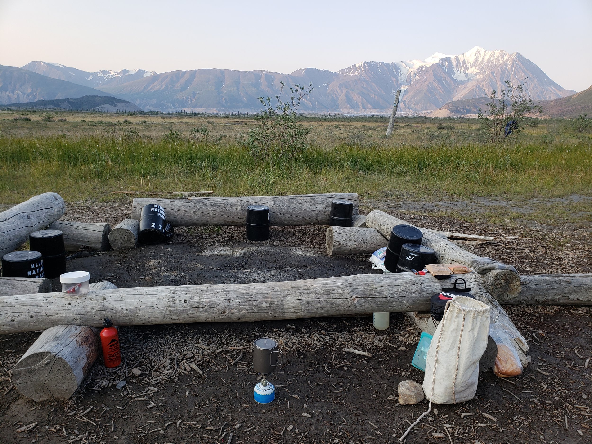
The log bench area where everyone seems to put their bear cans, along with our Ursack in the lower right corner.
Can't beat this view!
Soon we were at the primitive campsite at the 22.5km mark. The campground has an outhouse and some log benches where most people were storing their bear canisters. The stream near the campground was running very clear while we were there, but we were told that it can get very silty at times. There were a bunch of other people at the campsite, but it was really the only place for us to camp that night since we needed to be close to Observation Mountain in preparation for the next day.
Some people set up their tent in the trees close to the outhouse, while others set up on a hill above the stream. We chose the hill, so that we could get a cooling breeze through our tent. We were at such a northern latitude, that the sun didn’t drop behind the mountain until after 10pm, and it was a sort of perpetual dusk all night.
While we were cooking dinner, we talked with a German couple on vacation, who had just taken a flight-seeing tour over the glacier the day before. They told us that if we had enough money we should take a flight. Instead we were just hiking 45 miles and climbing a game trail up a mountain to get a view of the glacier.
Day 2
On day two, we summited Observation Mountain. There is no maintained trail up the mountain, so the day would involve some route finding. The suggested route is pretty straightforward though: cross Canada creek, hike up the canyon next to Canada Creek and then Columbia Creek, finally follow a narrow and steep game trail up a narrow ridge, and then into the alpine until you reach the summit. You would have to be very careless to get yourself lost on the summit attempt.
We started our hike around 7:00 am, after cooking a quick breakfast. The first order of business for the day was crossing Canada Creek. Just beyond the campground, Canada Creek braids over a wide alluvial fan. The further you go downstream toward the river to the east, the wider it braids and the easier it is to cross.

Walking out of the Canada Creek alluvial fan.

These photos do a good job of showing the texture of the many fans that have to be crossed on this route.
To save time when we crossed in the morning, we crossed fairly high on the creek closer to where it comes out of the canyon, cutting directly toward Observation Mountain. The water is generally higher in the afternoons, because the sun melts the snow pack at higher alpine locations upstream. We thought that taking a slightly shorter route in the morning would be a safe bet.
The first few small crossing went fine, but then we came to a much larger channel. The stream was wide, but fast and rolling in the place we chose to cross.
Neither of us have hiking poles (although I would highly recommend them for this trip), but I had picked up a gnarled Gandalf staff prior to one of the earlier crossings. Ian had Chaco sandals for the crossings, and I had brought a second pair of running shoes. We were definitely glad we had brought a pair of crossing shoes, and I think Ian would have liked to have a more substantial shoe for the crossings if he had had something better in the van.
Ian crossed first, because I was pretty nervous. The water was deeper than expected and Ian stumbled, and at one point it looked like he almost got pushed over by the water. So then I was super scared to go across.
Ian came a few steps into the deepest portion of the channel to give me a hand. I used my staff to work my way to Ian without too much trouble. However, once I got to Ian the water was well above my knees. The water was moving so swiftly that my feet were being pushed downstream. I’m fairly certain that if Ian hadn’t been there to help me stay upright, I would have been taking a swim.
After that crossing there weren’t any other channels to cross, so we put our dry shoes on for the hike up the canyon. We worked our way across the dry channels in Canada Creek’s alluvial fan. Since there is no trail we just worked our way up and down the banks of dry channels across the somewhat difficult surface to the bottom of the mountain. At that point we turned to our right to the northwest, and up the furthest channel of Canada Creek, until we reached Columbia Creek.
Once we reached Columbia Creek, we continued about a kilometer up stream looking to our left for the steep game trail that we would follow up Observation Mountain. There are several cairns on the way up Columbia Creek to follow. We found the game trail by a large cairn and a distinctly shaped orange rock. It would have been difficult to continue walking much further upstream, because there were rocky cliffs that came down to the water just beyond the trail.
Parks Canada describes the trail up the mountain as a game trail. The trail is more prominent than your average game trail, but it is incredibly steep. We both agreed that it was the steepest trail we had ever hiked on. You gain over 4,000 feet of elevation gain over about a less than three-mile distance, especially early in the hike. There are small switchbacks that are at most about four feet long, so you are essentially hiking straight up the mountain. The trail is for the most part on loose dust, gravel, and rocks, so it’s easy for your feet to slip out from under you.
It's more obvious than a game trail, but they weren't kidding about it being steep.

My wizard staff came in really useful for the water crossings and on the climb.
After a while we emerged above the willows and alder brush, to a narrow ridge. The trail drops off steeply on either side, and if you were to fall on this section, you’d be sliding down a long way.
After the narrow ridge, there is an even steeper section of trail. Finally, after we thought our legs were going to give out, we reached a wider, gentler, grassy, mossy area. The route description describes this as a wide alpine saddle, but we didn’t feel that we ever reached a distinct saddle. You start to get glimpses of the Kaskawulsh glacier to your right from the saddle.
At this point there are two options, you can head due south to the edge of the plateau or up to the summit. Either will give you a view of the Kaskawulsh Glacier, the summit just gives you a higher vantage point and you can see the headwaters of Slim’s River and the Kaskawulsh River. After completing the trail, it seems like reaching the summit is probably just as easy as reaching the plateau, because the most difficult part is over. We were headed to the summit.
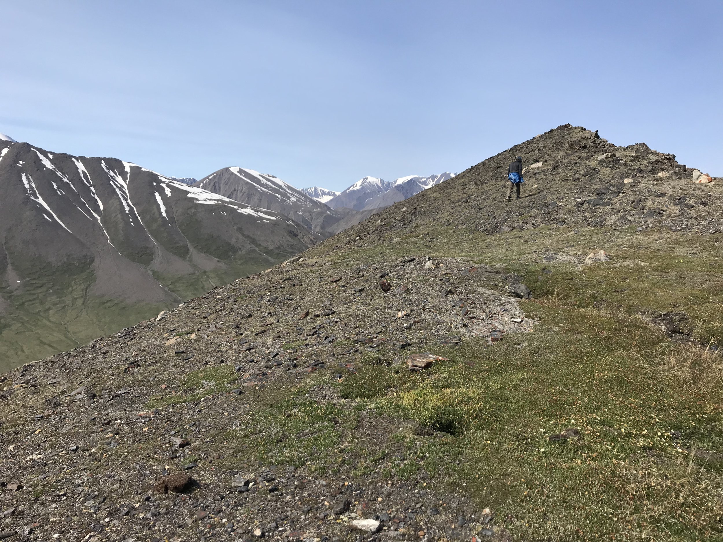
Walking once above the saddle is a lot less steep, but there is no game trail to follow.

This photo shows the plateau that you can walk to instead for views of the glacier. Once you reach the saddle, you will get encouraging glimpses of the glacier to your right.
In the mossy area, the trail peters out, but it’s really obvious where we had to go—up, up, up, until the summit. There is a wash with light colored rocks that we followed up. Once we were in this area, it was a lot easier going, mostly because we were walking on alpine tundra and large rocks, rather than loose dust and gravel.
There is one steep false summit with exposed rock. After ascending the false summit, you can see another small peak and the true summit peaking out behind.
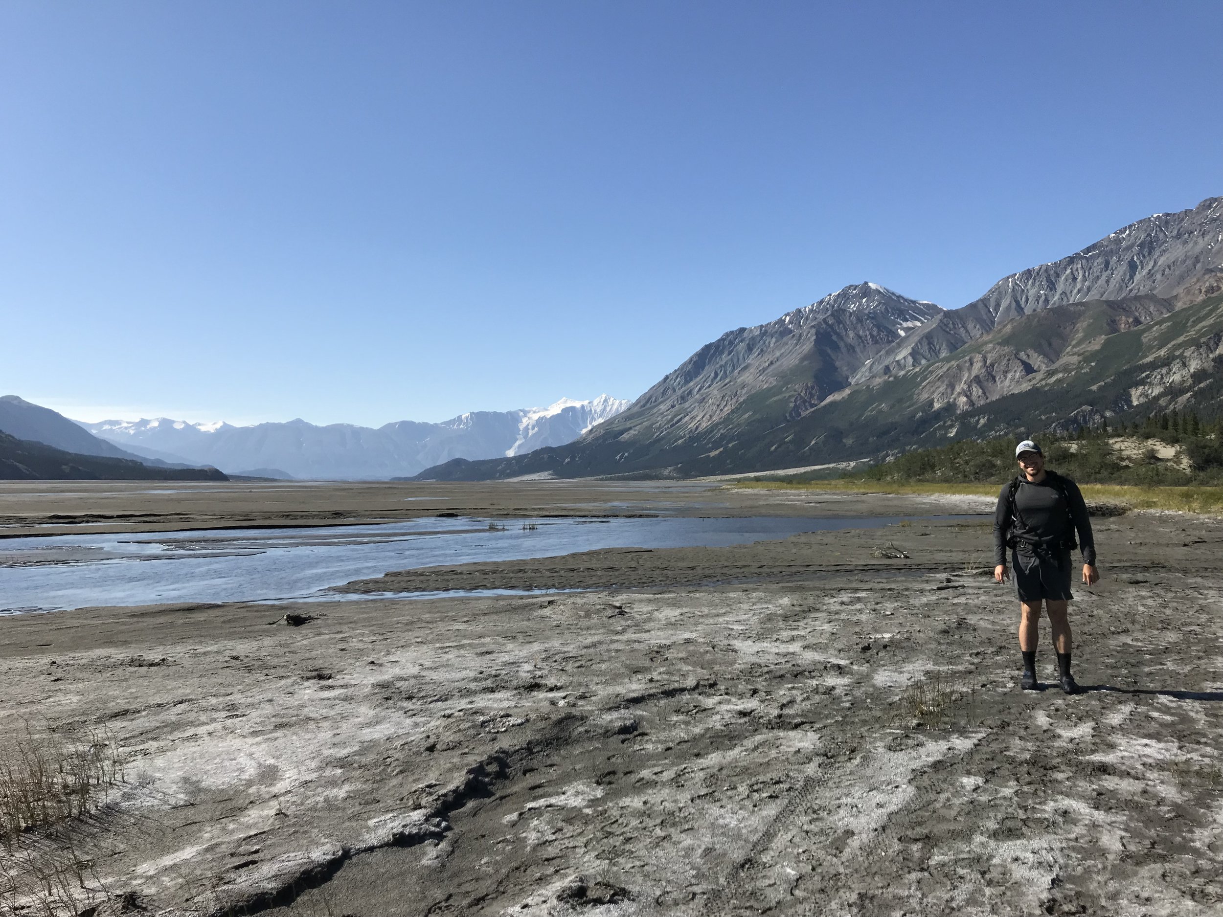
Before we knew it we were on the summit. Suddenly we could see the entire Kaskawulsh Glacier with its two curving arms on either side of Mt. Kaskawulsh and meeting just behind the mountain, then winding its way through the valley. At the toe of the glacier, the ice is breaking off into an milky blue gray lake. Beyond the lake, you can see the headwaters of the massive Kaskawulsh River and the smaller Slim’s River snaking through the Aay Chu Valley.

Ian sits and takes in the view of the mighty Kaskawulsh Glacier and the St. Elias Range beyond.
Climate change has completely redrawn the landscape around Observation Mountain. Over the course of four days in 2016, the once immense Slim’s River essentially disappeared. For hundreds of years, the melt water from the glacier was split roughly between the Kaskawulsh River and Slim’s River. Almost overnight, due to the rapid recession of the glacier, the course of the river was diverted nearly entirely into the Kaskawulsh. The melt water now flows into the Gulf of Alaska, thousands of miles from its original destination in the Bering Sea.
This is the first documented case of “river piracy,” in which the flow of one river is diverted into another. Slim’s River, once nearly 500 feet across has been reduced to a mere trickle snaking through the mudflats and dust of the former riverbed. In a geological instant, the landscape was rapidly altered by human-caused climate change.
Climate scientists warn that anthropogenic climate change could cause other glacially fed rivers to change course, with negative consequences for the communities downstream dependent on the rivers as sources of water. While the Yukon is very sparsely populated, other regions dependent on glacially fed rivers and their ecosystems are much more populous.

The glacier is the main course of this backpacking route, and the valley hike is just an appetizer.

The effect of climate change is apparent when overlooking the toe of the glacier. The now massive Kaskawulsh River is in the background.
Although the mudflats and dust we had walked through the day before were a result of the once massive river, now shrunken, it wasn’t until we were at top that we could truly see the result of the glacier's recession. Although most people understand that climate change is occurring, it’s rare that you can see it right in front of you. The glacier, the valley, and the mountains were beautiful, but it’s also sad to think how much the landscape has changed in the last few years.
We were sharing our vantage point at the top of the mountain with a herd of white Dall Sheep with their lambs. They look much like Bighorn Sheep except that they are white. The herd had left behind a great deal of wool behind in tufts on the rocks. It was so soft! In the valley, Ian had found one of the ram’s massive curling horns and that thing was heavy! Probably 20 pounds!

It's the circle of life... unlike ungulates like deer and elk, sheep don't shed their horns, so this hefty horn must have been from a sheep that died.
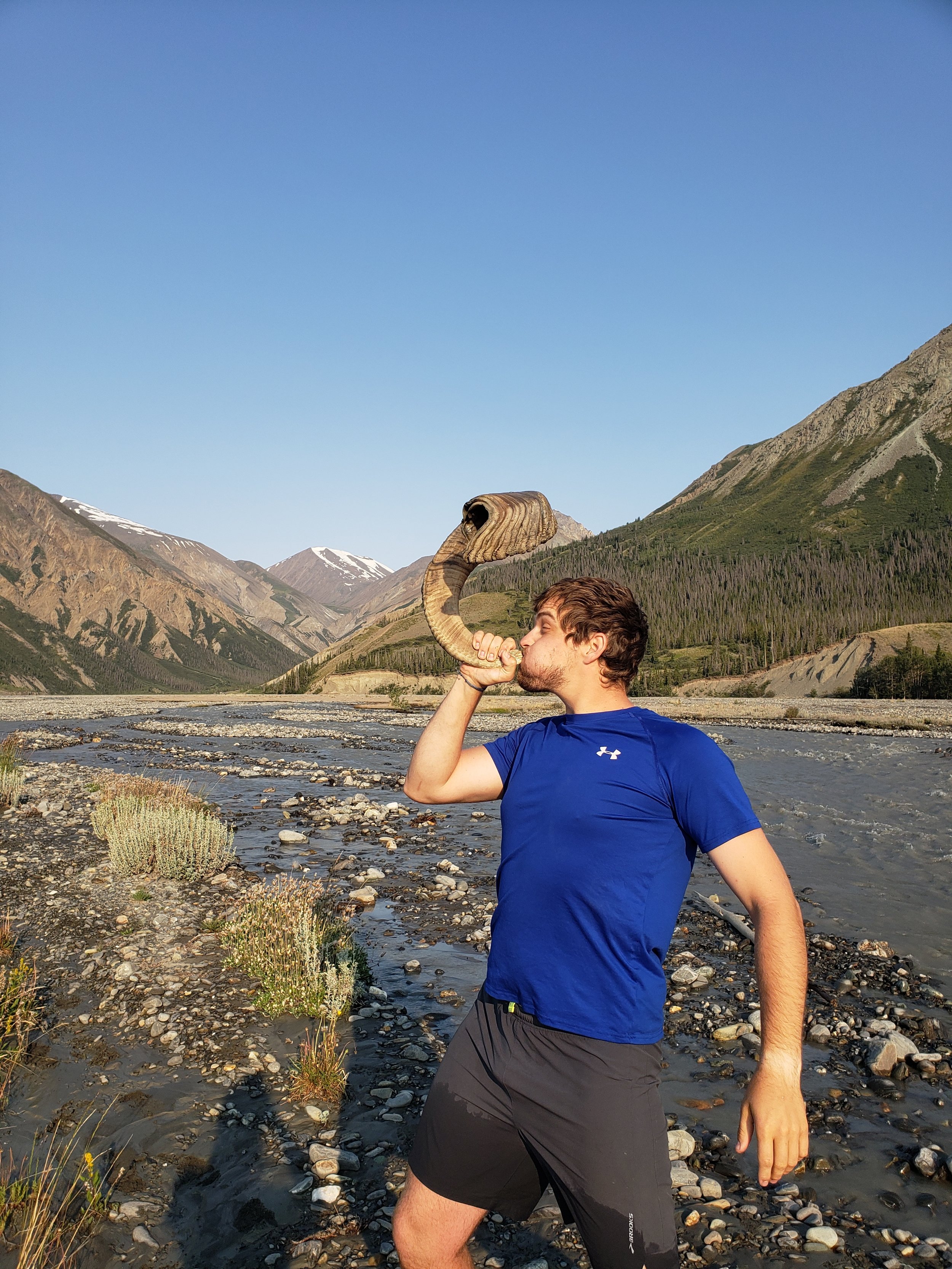
Ian sounds the horn of triumph after crossing the high water on Canada Creek. He actually put his mouth on it!

Dall sheep on the other side of the summit of Observation Mountain.
We tried to walk to the end of summit to see if we could see the campsite, but it was blocked from view by a series of benches on that side of the mountain. Nor can you see the summit of the mountain from the campsite.
After enjoying the view for a while, we headed back knowing we had a long way to go and that since it was a hot day, the creek would be rising all afternoon. We sped through the less steep area at the top until we reached the crazy steep grades. The narrow ridge was even scarier on the way down. Far scarier. I think Ian congratulated me when we got across.
The final mile of the descent was the most difficult, because the gravel is so loose. Fortunately the one time that I fell on my butt, I only slid a few feet because I was able to grab onto some nearby buffalo berry bushes.
We finally made it to the bottom of the mountain. The air in the canyon was stifling and we knew the Canada Creek crossing was likely to be much higher because of snowmelt. When we reached the place where Columbia Creek joined Canada Creek, the water was so much louder and faster than it had been in the morning.
We walked far downstream, until it looked safe to cross, rather than trying to take a more direct route to the campsite. At one point we could literally see the water rising. New, extremely muddy channels were forming right before our eyes, with trickles of water running through them for the first time that day. I’ve never seen water rising so visibly.
At this point we were far down the braids, and we started crossing, feeling like it was race against the rising waters. Fortunately none of the channels we had to cross were much deeper than mid-calf, so they weren’t too challenging. The water was so much siltier though, so it made it difficult to gauge the depth of the water.
Finally we reached the campsite, about 15 miles of hiking, around 6pm. We cooked dinner there, which tasted so good! We decided to pack up our gear and head another 4.3 miles to another recommended camping area so that we wouldn’t have to walk so far the next day and so that we could camp without a bunch of people around us.
By 7:15pm we were back on the trail, headed north. Parks Canada recommends three different alluvial fans for camping, while others are not recommended due to higher bear and water hazard risks. We aimed for the closest of the recommended alluvial fans at the 14.3 km marker. It took us about two hours to get there, and we arrived fairly footsore around 9:30pm. It was nice to know that the most difficult part of the next day’s hike was already done though.
The campsite we chose was absolutely beautiful, on a flat part of the fan without any brush around it. It was great to actually feel like we were camping in the wilderness, without a bunch of strangers around us as well. It was very windy and cool, and we watched the pink light on the mountains fade as we set up our tent and tied our Ursack to a log far from the tent.

Slim's River was much larger and muddier on our way out.

Ian gets his sleeping bag out while the moon rises over the mountains behind.
Day 3
The next morning, we woke up and struggled to take the tent down without it blowing away. It was pretty chilly in the wind, but we could see the rays of sun running over the mountain. We were grateful for the chill, knowing it would soon be very hot.
The predawn mountains with rays of sun streaming over the peaks.
The first part of the hike on the mudflats was lovely, just as it had been two days earlier. It was really cool to see how much the water had risen due to the hot weather. We crossed a bunch of tiny streams that had been dry on the way in.
After about 9km, we reached Bullion Creek again. It was flowing so much higher than the first time we went through. It was clear we wouldn’t be crossing where the trail meets the creek. We weren’t that concerned though because the park ranger had suggested that we just head up to a kilometer down stream to where the creek braids.
We did that and the stream did braid somewhat, but the channels were still really high and turgid. We headed even further down. The problem was that the braids did not spread widely like Canada Creek, and they kept converging back together so they remained deep and swift.
After walking about a mile downstream, we unbuckled our packs and crossed at a place where a logjam upstream was slowing the water so it was fairly flat. Once we had crossed that channel, we were standing on a tiny gravel bar that wasn’t even above the surface of the water, with an even deeper channel to cross on the other side. We caught our breath and crossed, with Ian standing upstream from me to block some of the current, which seemed to help a lot.
After crossing a few more small channels, we walked the mile upstream back to the trail. Then were back on the old mining two track. It was easy, but hot and dusty walking. There was the boggy area before Sheep Creek to walk through, so we just left our creek crossing shoes on for the rest of the hike. Sheep Creek was again easy to cross, though it was higher.
This portion of the trail is very desert-like.
Ian by the much higher river on the way out.
The last 2.7 km felt like the slowest, most boring part of the hike, because we were so hot. We did see some very fresh bear scat full of buffalo berries. It also looked like the bear had eaten so many berries that it had puked twice while walking, so we were a little on edge about encountering a bear with a stomachache.
Getting back to the van and into the AC felt so good. We went to the visitor center and deregistered, where we just had to answer a few questions about the high water and if we saw bears. We concluded our day with some beers and poutine at one of the few venues in nearby Haines Junction.
As a whole, it was an excellent backpacking trip, with many challenges but highly rewarding scenery. Driving through the Yukon on the Alaska Highway was very beautiful, but there wasn’t much “to do.” The towns are very small and there are few developed hiking trails. Accessing most of the land requires a bush pilot, a boat, or extensive wilderness navigation skills and planning. In Kluane, we were able to see a beautiful glacier without spending much money and mostly walking on trails. By Yukon standards, it was an easy trip!
We’d definitely recommend the trip to anyone looking to explore a Canadian national park without hiring a guide or encountering the crowds in places like Banff or Jasper.

Posts also tagged:
Abandoned Places, Alaska Highway, Backpacking, Bighorn Sheep, Bullion Creek, Camp Food, Canada, Canada Creek, Canyons, Climate Change, Columbia Creek, Dall Sheep, Free Camping, Geology, Glaciers, Grizzly Bears, Haines Junction, Hiking, History, Kaskawulsh Glacier, Kluane Lake, Kluane National Park, Moose, Mountains, National Parks, Observation Mountain, Parks Canada, Salt Flats, Sand Dunes, Sheep Creek, Slim’s River, Stream Crossings, Summit, Trails, Travel, Vanlife, Whitehorse, Wilderness, Wildlife, Wolves, Wrangell-St. Elias National Park, Yukon
Have you visited Kluane National Park? What are your favorite spots? Leave a comment below.